
06 Apr, 2019
EU team keen on collaborative projects in Arunachal Pradesh using Remote Sensing Technologies
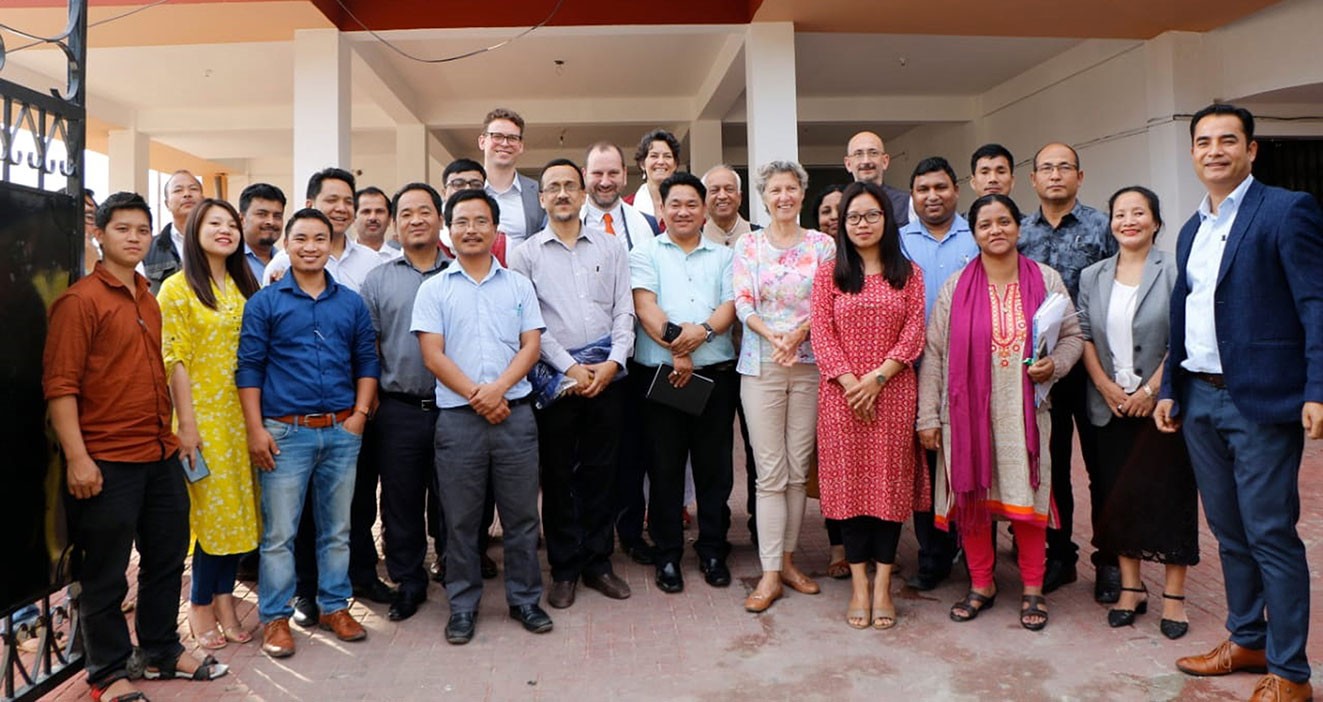
A seven member delegation from the European Union, after visiting the office of the State Remote Sensing Application Centre, here on April 5, expressed their desire to offer collaborative research based projects in the sectors of Agri-horticulture development, Geo-hazards mapping, climate change studies, 3D modelling of archaeological sites by using UAV applications and remote sensing technologies.
The EU team headed by Tania Friedrichs comprising delegates from Norway, Italy, France, Belgium and Denmark said that Arunachal Pradesh shares common challenges in terms of environmental issues with the European countries and there is a tremendous potential for scientific based research projects using remote sensing technologies in this state. Such informed collaborative projects can be availed through the regular Horizon 2020 calls for collaborative research proposals under bilateral or multilateral funding, EU team said.
Stressing on improving knowledge transfer between research institutions across the member countries, the team also spoke about generating new knowledge to enhance productivity services for sustainable resources using innovative technology to address the societal challenges. They also inquired about the formalities on sharing satellite data with the international research institutions since the state falls under restricted areas due to sharing of international boundaries with neighbouring countries.
Earlier, Director SRSAC, Dr H Dutta made a detailed presentation on initiatives taken by SRSAC on use of space technology for development of Arunachal Pradesh. During interaction with the EU team, Joint Director, SRSAC, Tana Tage stressed on application of drone technologies in 3D mapping, GIS based web application for exploring the solar energy potential of building rooftop in urban areas, acreage estimation of agricultural land, Geo-hazard vulnerability areas mapping etc.
The EU team was impressed with the SRSAC for undertaking innovative research projects in multi-disciplinary fields of remote sensing and GIS technologies.
Later on the day, they also visited the exhibition stall and witnessed live demonstrations on different projects by the scientists/engineers of SRSAC in our GIS Laboratory.